A place of rolling hills and red gums
Vision: A thriving landscape, where production compliments the grasslands and red gum woodlands between the upper Glenelg and Wannon Rivers
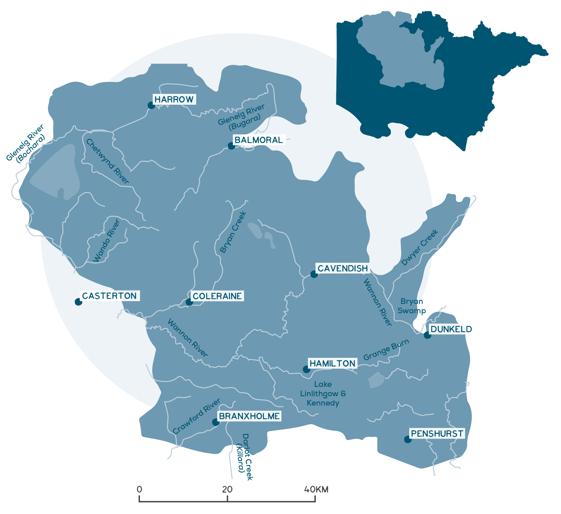
The North Central Tablelands is in the north of the catchment and has a population of about 16,000 people.
Traditional Owner organisations managing country include Barengi Gadjin Land Council, Eastern Maar Aboriginal Corporation and Gunditj Mirring Traditional Owners.
Agriculture, forestry and fishing are the largest industry employers in the area, with the Hamilton Regional Livestock Exchange being the second-largest sheep selling centre in Victoria and South Australia, processing an average of 1 million sheep per year.
Key Landcare networks include the Upper Glenelg Landcare and Hamilton Landcare Consortiums, the Hamilton Field Naturalists Club, and Panyyabyr and Mirranawta Landcare groups.
Local Government Authorities include Southern Grampians Shire, West Wimmera Shire and Horsham Rural City Council.
A snapshot of the North Central Tablelands
- Key towns include Hamilton, Dunkeld, Penshurst and Coleraine.
- The area is well suited to broadacre farming – sheep and wool are the key industries.
- Native vegetation covers 21% of the area.
- Important conservation reserves include Gatum, Derghom State Park and Dundas Ranges.
- Key waterways include the Wannon River, Crawford River and northern reaches of Darlot Creek and Glenelg River.
- Nigretta and Wannon Falls are popular visitor locations on the Wannon River.
- There are about 800 wetlands in this area – largely freshwater and deeper temporary and permanent lakes a feature.
- The area connects to many significant tourism locations.
- Consistent threats across this heavily cleared and developed local area are clearance of native habitats, including riparian zones, wetlands and their buffers, disruption to connected habitats, the impacts of pest plants and animals, and water availability.
Detailed overview
The rolling hills, steep valleys, fertile soils and regular, reliable rainfall makes this local area well suited to broadacre grazing. For this reason, the area has been considered the heartland of the region’s thriving sheep and wool industry since European settlement in the 1830s. In recent times, there has been some shift towards grain production in the north of the region. Beef cattle, cropping, timber, intensive horticulture and viticulture are some of the other industries diversifying production in the area. Agriculture will remain a key industry into the future, with some transition to address higher temperatures and reduced rainfall under a changing climate. The urban influence on agricultural land use is limited to a small area around the town of Hamilton.
The North Central Tablelands includes a large portion of the Dundas Tablelands and the north-west section of the Victorian Volcanic Plain (VVP) bioregions. This landscape was once dominated by grassy red gum woodland at the time of European arrival but is now one of the most heavily cleared areas in the Glenelg Hopkins region. Native vegetation only covers 21% in this local area and has declined by 26% since 1990. The reduction in native vegetation over this period has predominantly been through losses in native grassland (46% loss since 1990) and seasonal wetlands (11% loss since 1990). Forest and woodland cover have increased slightly (3%). However, scattered trees which historically dominated the area, have continued to decline with loss accelerating over the past decade (3% loss since 2010).
The North Central Tablelands provides habitat for a recorded 34 threatened species. These include 26 fauna species such as the striped legless lizard (endangered), southern brown bandicoot (threatened) and brolga (vulnerable), and eight flora species including buloke (endangered), clover glycine (vulnerable) and the Dergholm guinea-flower (vulnerable).
Red gum paddock trees are important as shade tees for livestock and habitat for native animals
Lake Hamilton
Photo: Southern Grampians Shire
The threatened southern brown bandicoot
Photo: Ian McCann
The region contains several small but important areas of remnant vegetation. For example, the red gum woodland along the Glenelg Highway east of Dunkeld is considered the best example of grassy eucalypt woodland of the VVP remaining in the region (an ecological community that is critically endangered). The Gatum Gatum Nature Conservation Reserve at the foot of the Dundas Ranges is one of the best examples of the remnant woodland vegetation that once dominated the region. The largest areas of remnant vegetation can be found south of Rocklands Reservoir, in Dergholm State Park and the Dundas Ranges. These areas are dominated by stringybark vegetation and are on relatively poorer agricultural soils, which is likely to have favoured their persistence in the landscape. The red gum woodlands in the Victoria Valley are amongst the most herb-rich woodlands in Victoria. The western portion of this area features extensive heathy woodlands, commonly consisting of brown stringybark, tea-tree and sedges.
This local area is entirely land locked and contains the upper catchments of some of the region’s most significant waterways, including the Glenelg River, Wannon River, the Crawford River and the northern reaches of Darlot Creek. Rivers in this area reveal the legacy of geological upheavals with several significant waterfalls. Wannon and Nigretta Falls, as well as Lake Hamilton (within the town of Hamilton), are popular places for visitors to the region.
The Wannon River contains ecologically healthy reaches of high environmental value and has also been identified as key to landscape connectivity:
- The Wannon floodplain plays a key role in improving water quality for the lower Glenelg River.
- The Wannon rapids area contains around 237 different native plant species and is of high conservation value.
Challenges and threats
Predicted climate trends of warmer temperatures and reduced rainfall in this area increase the potential for over-grazing, leading to bared soil, particularly over summer. The highly dispersive underlying sodic clays of the North Central Tablelands soils are also readily washed away by moving water. Where sodic layers become exposed through grazing on valley slopes and gullys, or cultivation, tunnel, gully and sheet erosion can result as surface, and sub-surface water flows wash fine clay particles into rivers and wetlands. Management of groundcover in susceptible areas is needed to reduce erosion risks. On-going farm production and the natural susceptibility of volcanic soils to acidity, means soil acidification remains a threat in this area.
Drainage, the diversion of water, reductions in rainfall and the implications of potential changes in the availability of environmental water (for the Glenelg River) all affect the condition of waterways and wetlands. Water availability more generally, will be a key issue under climate change, particularly as industry diversification such as horticulture, viticulture and plantations are explored to boost the region’s economy. Secure water supplies will be crucial to provide opportunities for further industry development.
The effects of climate change will also be significant for aquatic species that require permanent water for survival, including fish, platypus and crayfish. In rivers, prolonged cease-to-flow events will challenge the persistence of those species, unless they have access to deep pools that can retain water until flows resume and contain appropriate water quality for survival. Because of this, protected areas will become increasingly important as they provide refugia, reduce the overall sensitivity and increase adaptive capacity across the landscape. There is also a legacy of waterway sedimentation across the Dundas Tablelands in the western portion of this area.
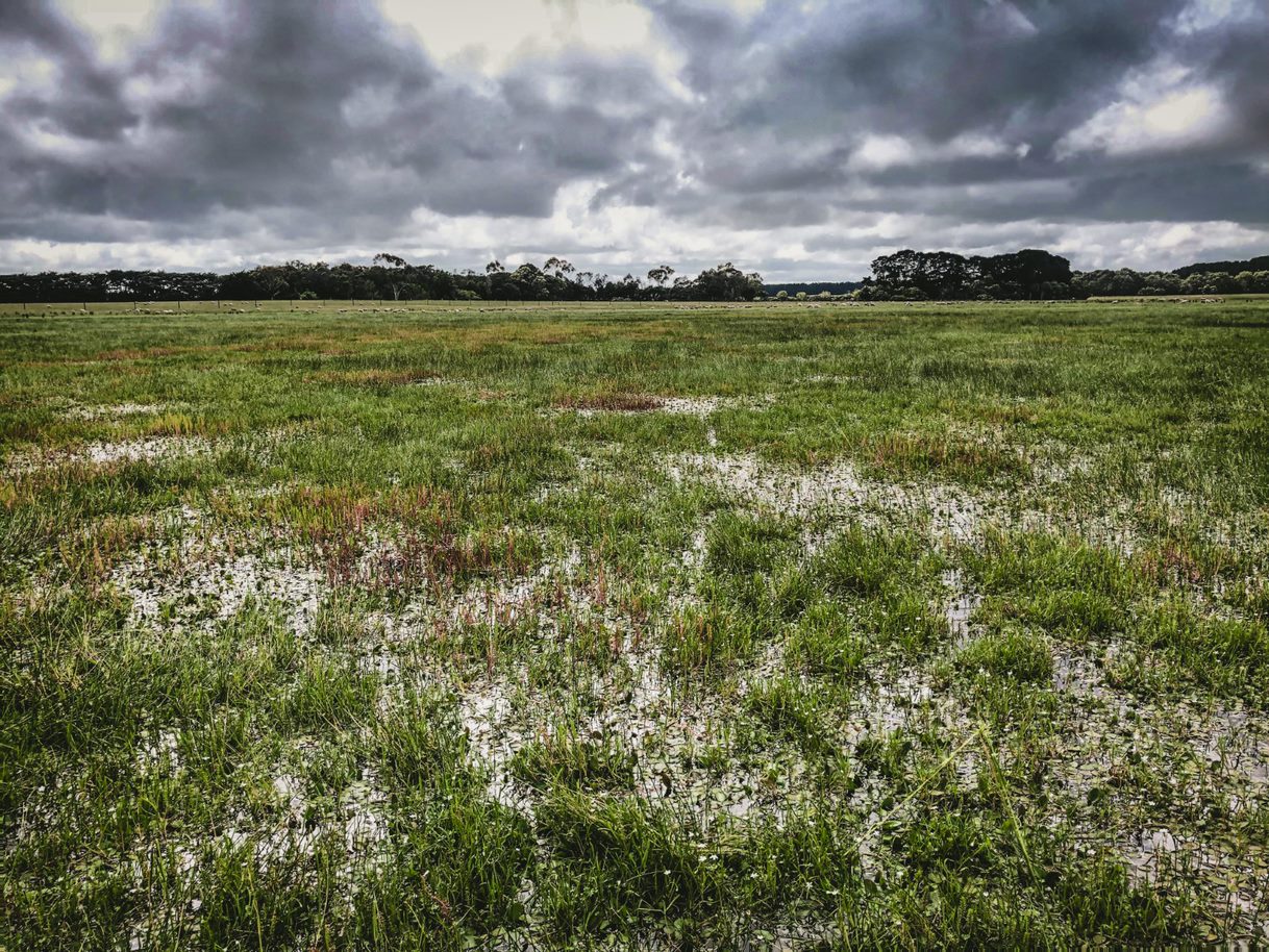
Outside of public land reserves, wetlands across this area are often in poor condition, affected by the loss of buffer zones, drainage, and the impacts of grazing.
While flooding can become a serious problem for the community if not adequately managed, it is a natural process and important for river system health. Towns within this local area that are at risk from mostly riverine flooding include Hamilton, Dunked and Coleraine. With changes to rainfall intensity and frequency under climate change, reducing flooding risk is an important consideration for community and economic wellbeing.
Crawford River
Red gum walk at Balmoral
Photo: Southern Grampians Shire
2016 Coleraine flood
Habitat loss is a major threat to biodiversity. Remaining high-quality remnant patches of vegetation are generally small and vulnerable to pasture grass invasion and species decline through an absence of historical disturbance regimes. Stock grazing has largely limited red gum recruitment to roadsides and small refugia sites, which may lead to future population collapse. Red gum dieback has also become evident across parts of this local area, possibly in response to climate change. Woody plant encroachment of both native species, such as hedge wattle, and non-native species, such as pine, has become common in some areas of woodland. As dense canopies develop this is likely to reduce native plant recruitment in the future. The overabundance of kangaroos also has impacts on native habitat and revegetation efforts. Pest plants and animals are consistent threats across this heavily cleared and developed local area.
This local area also connects to many significant tourism locations within other local areas including the Gariwerd (Grampians National Park), the volcanic landscapes of the south-west that are rich in Aboriginal culture (such as Budj Bim World Heritage Landscape) and even the Coonawarra wine region in South Australia. Expanding tourism within the area to capitalise on natural and cultural assets is a major opportunity for the area, as well as a challenge in being able to secure more of the market share from across the region.
Key socio-economic challenges include:
- A relatively young, but declining, rural population due to farm aggregation.
- Low rates of post-secondary qualifications creating skills gaps.
- Distances to major cities and accessible transport routes affecting industry.
- Limited local value adding to agricultural products and decline in manufacturing.
Community priorities and interests
The outcomes and priority management directions for the strategy are detailed under each theme, these set the strategic framework for the strategy.
Although all outcomes in the RCS are a priority across the region, each local area has different priorities for implementation based on the local values, threats, and community priorities. The strategy will be implemented via specific projects, or the core activities of a range of agencies, groups and local people involved in managing and conserving natural resources and biodiversity values.
Community priorities and interests that relate to the North Central Tablelands local area are outlined below. These priorities and interests have been raised by community and partners through the RCS engagement process. These are also reflected in the priority management directions under each theme and together they guide the implementation of the RCS within the different local areas.
Traditional Owner groups
Further detail on Traditional Owner groups in this local area can be found on their individual pages – click the names below:
* Barengi Gadjin Land Council
* Eastern Maar Aboriginal Corporation
* Gunditj Mirring Traditional Owners Aboriginal Corporation


